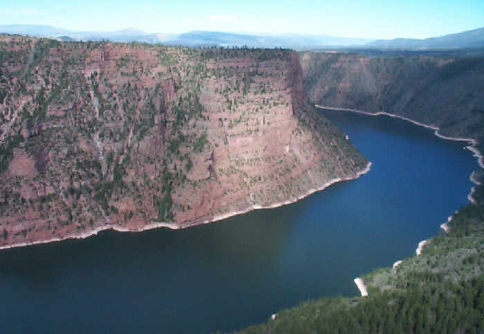
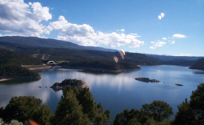
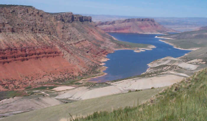
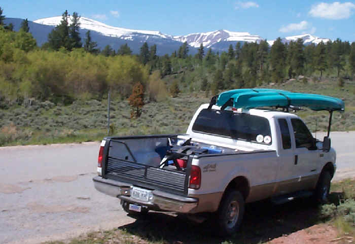
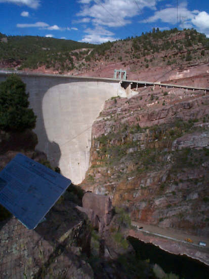
 Flaming
Gorge is on the Green River in northeastern Utah. We had a beautiful and secluded
camp spot high on a hill above the lake. There
is a terrific view of the gorge from the visitor
center 1,700 feet above the 400 foot deep water. The "flaming" pink
canyon walls and the deep blue water in the gorge make a great contrast. As
a first order of business, we put the kayaks in
the water to check it out.
Flaming
Gorge is on the Green River in northeastern Utah. We had a beautiful and secluded
camp spot high on a hill above the lake. There
is a terrific view of the gorge from the visitor
center 1,700 feet above the 400 foot deep water. The "flaming" pink
canyon walls and the deep blue water in the gorge make a great contrast. As
a first order of business, we put the kayaks in
the water to check it out.
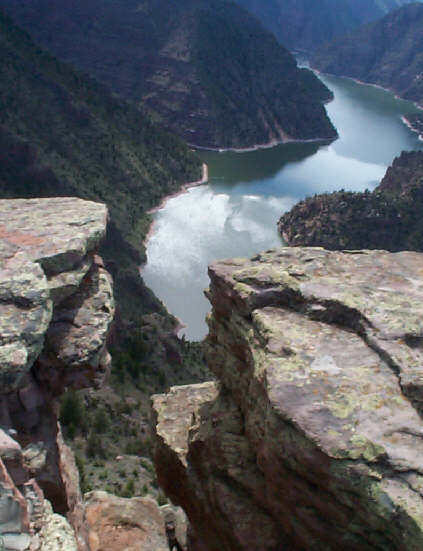
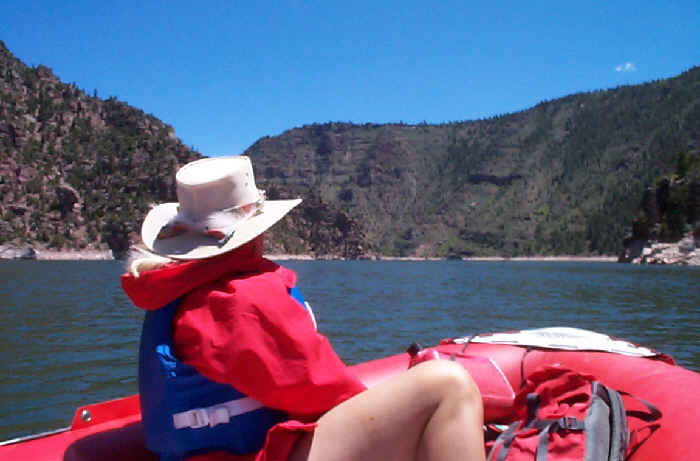
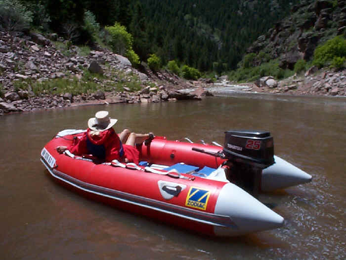
 The
lake is 90 miles long. We broke out the Zodiac and motored 13 miles up the
canyon to the spot we were viewing from the visitor
center. The Utah part of the canyon is spectacular with high walls and creeks
running into the lake from every side canyon.
The Wyoming part is a little less dramatic; mostly bare but colorful
hills.
The
lake is 90 miles long. We broke out the Zodiac and motored 13 miles up the
canyon to the spot we were viewing from the visitor
center. The Utah part of the canyon is spectacular with high walls and creeks
running into the lake from every side canyon.
The Wyoming part is a little less dramatic; mostly bare but colorful
hills.
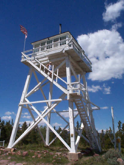
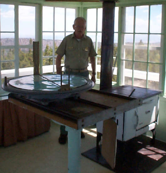
The lake behind the dam runs through the foothills of the High Uintas ("you intas"). This is the part of the Rocky Mountains where the first beaver trapper's rendezvous was held. We took a dirt road out to see the last remaining wooden fire tower in the state. The old man working the fire tower had all the comforts of home up there: bed, wood stove, etc.
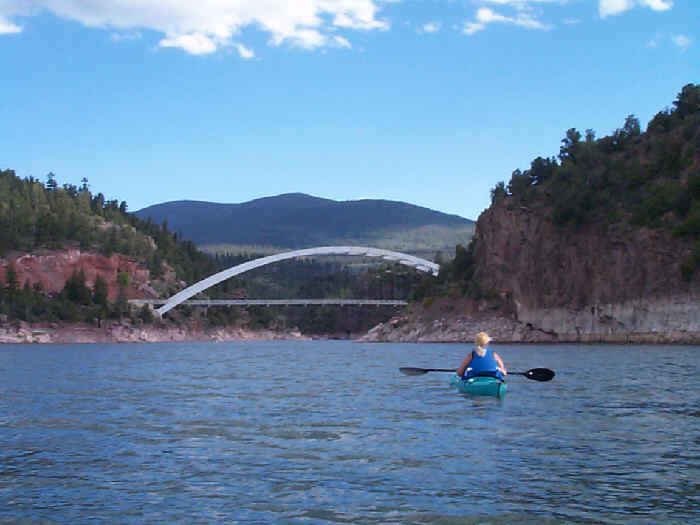
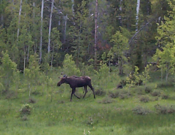 Everywhere
we looked we saw wildlife. Patty saw 3 river otters when we kayaked the river
below the dam, and we were able to get close enough to take a picture of this
shy young moose. When he first saw us he tried to hide behind a small sapling
that hid nothing but his eyes. We let him think that worked by saying "what
moose? I don't see a moose."
Everywhere
we looked we saw wildlife. Patty saw 3 river otters when we kayaked the river
below the dam, and we were able to get close enough to take a picture of this
shy young moose. When he first saw us he tried to hide behind a small sapling
that hid nothing but his eyes. We let him think that worked by saying "what
moose? I don't see a moose."
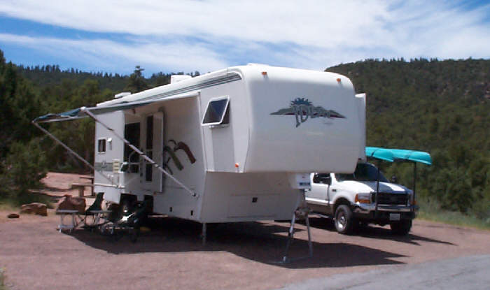
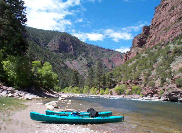
The most exciting thing we did here is float the Green river through the rapids below the dam. The Dept of the Interior publication for Flaming Gorge describes a float trip down the river as: "a leisurely pace with occasional rapids injecting excitement". Let me tell you, the "excitement" is enhanced when you do it in 15 foot long sea kayaks that were not designed for maneuverability.
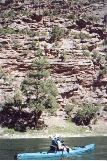
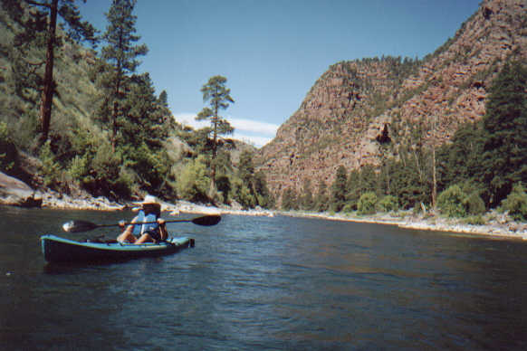 We
put-in just below the spillway and floated with
the (strong) current through a long gorge below the
dam. We were admiring the the bright pink rocks that
gave the gorge its name and almost didn't notice the first
rapid, which we negotiated without a problem. The name of the first rapid,
by the way, is Anticipation (as in anticipation of the second
rapid - aptly named Deadman). The second rapid is a true class
3; the worst on this part of the river. A man and his young son were in front
of us in a rented whitewater kayak. Patty and I held back to see which route
they were going to take through the rapid. All of the sudden, they dropped
out of sight! When they got far enough from "the lip" that we could see them
again, their kayak was bouncing like a rocking horse.
We
put-in just below the spillway and floated with
the (strong) current through a long gorge below the
dam. We were admiring the the bright pink rocks that
gave the gorge its name and almost didn't notice the first
rapid, which we negotiated without a problem. The name of the first rapid,
by the way, is Anticipation (as in anticipation of the second
rapid - aptly named Deadman). The second rapid is a true class
3; the worst on this part of the river. A man and his young son were in front
of us in a rented whitewater kayak. Patty and I held back to see which route
they were going to take through the rapid. All of the sudden, they dropped
out of sight! When they got far enough from "the lip" that we could see them
again, their kayak was bouncing like a rocking horse.
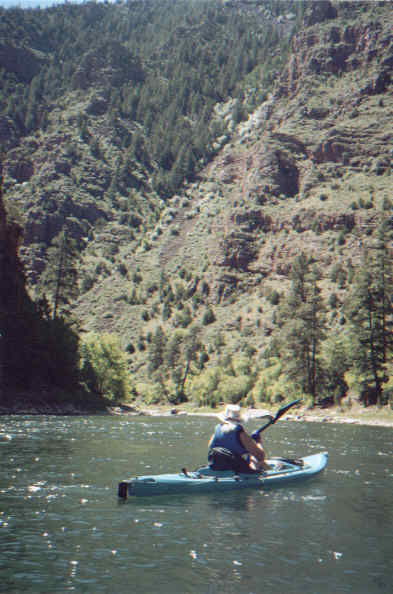
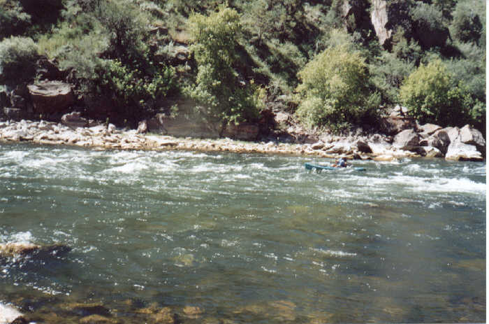
When Bob headed into the rapid, the current and the wind conspired against him and he was dumped into the COLD water. Fortunately, he was holding onto his paddle, and the leash kept his kayak from floating to Colorado.
Patty was understandably unnerved. But with no other choice, she set a death-grip on her paddle and headed into the current. She made it without a hitch and raised her paddle in the standard kayaker's cheer; claiming that SHE was the better kayaker. Some people just don't understand how much REAL skill it takes to do (half) an Eskimo roll without losing your hat, sunglasses, camera, and kayak.
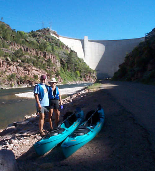
 We
honed our skills on the next 5 (named) rapids. By the time we got to the take-out
point we were feeling pretty confident. Ask either of us if we would do it
again, and the answer would probably be "yes, but not this year".
We
honed our skills on the next 5 (named) rapids. By the time we got to the take-out
point we were feeling pretty confident. Ask either of us if we would do it
again, and the answer would probably be "yes, but not this year".
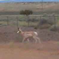
Our next point of call was Dinosaur National Monument. The campground was pretty barren compared to the one we left at Flaming Gorge. It did, however have a pronghorn antelope that would sneak in and browse around the camp sites.
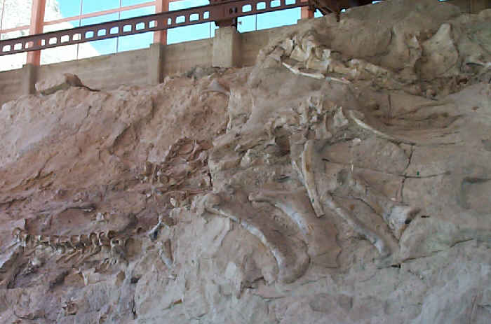
The "dinosaur" part of the monument was interesting because they left many of the bones in the rock where they were found. The visitor center is built around the rock, which has been tilted to a 69 degree angle by uplift within the earth's crust.
Contrary to popular belief, the monument is not salted throughout with dinosaur bones. It is just that one very limited area that was once a sandbar on a prehistoric river. Floods would come through and drop victims on that sandbar. If the carcasses were buried quickly enough, the silt would prevent deterioration and the bones would be turned to stone.
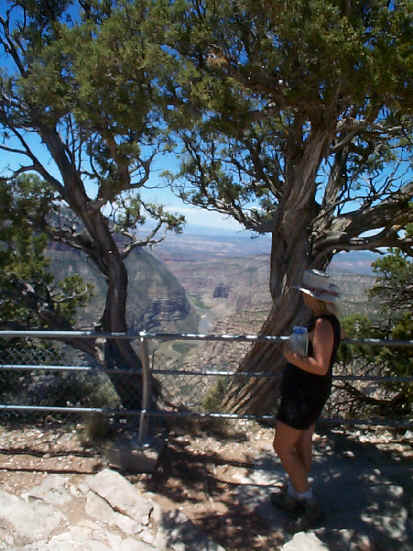
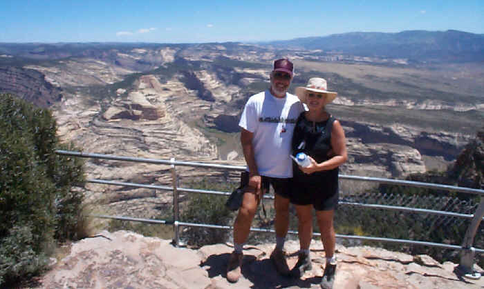 The
largest area of the park protects the canyons of the Green and Yampa rivers.
We drove out onto a long hogback ridge and looked down at their confluence.
The Green river comes in through a red walled
canyon while the Yampa cuts its way through tan sandstone.
The
largest area of the park protects the canyons of the Green and Yampa rivers.
We drove out onto a long hogback ridge and looked down at their confluence.
The Green river comes in through a red walled
canyon while the Yampa cuts its way through tan sandstone.
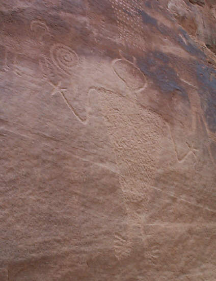
We found a lot of Fremont Indian rock art hidden away in this area. We thought this one example showed very clearly how the ancient culture chipped their petroglyphs into the rock instead of simply scratching them onto the surface.